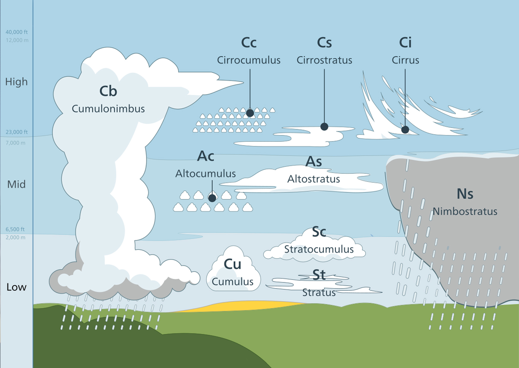
Cloud is an aerosol consisting of a visible mass of very small liquid droplets or ice crystals in the atmosphere. Although this definition seems quite boring, clouds themselves are definitely not. It’s the clouds that create the atmosphere of every single moment of the day. Furthermore, clouds can also tell us a lot about the weather that is going on – well, on condition that you interpret them correctly. According to the World Meteorological Organization's International Cloud Atlas, there are more than 100 kinds of clouds. The many variations, however, can be grouped into one of 10 basic types depending on their general shape and height in the sky, as you can see in the picture.
Whether you're interested in cloud watching or just curious to know what clouds are overhead, go through the gallery to find out how to recognize them and what type of weather you can expect from each. Or use the poster CLOUD IDENTIFICATION GUIDE from The World Meteorological Organization.
Special task: In case clouds you find this interesting, take your own photos of the clouds and make your own gallery of all ten types.
Ten types of clouds
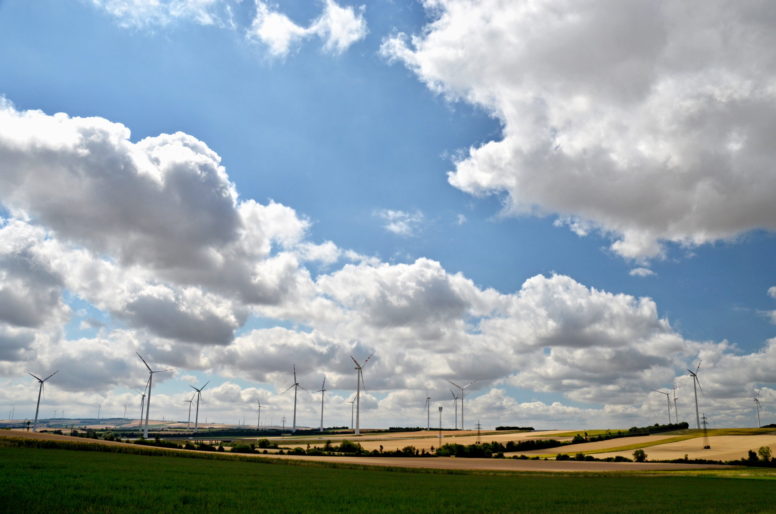
11.3a – Cumulus clouds are the clouds you learned to draw at an early age and are today considered a symbol of all clouds. Their tops are rounded, puffy, and a brilliant white when sunlit, while their bottoms are flat and relatively dark. Cumulus clouds develop on clear, sunny days when the sun heats the ground. That is why they got their nickname of fair weather clouds. They appear in the late morning, grow, and then disappear toward evening. Zdroj
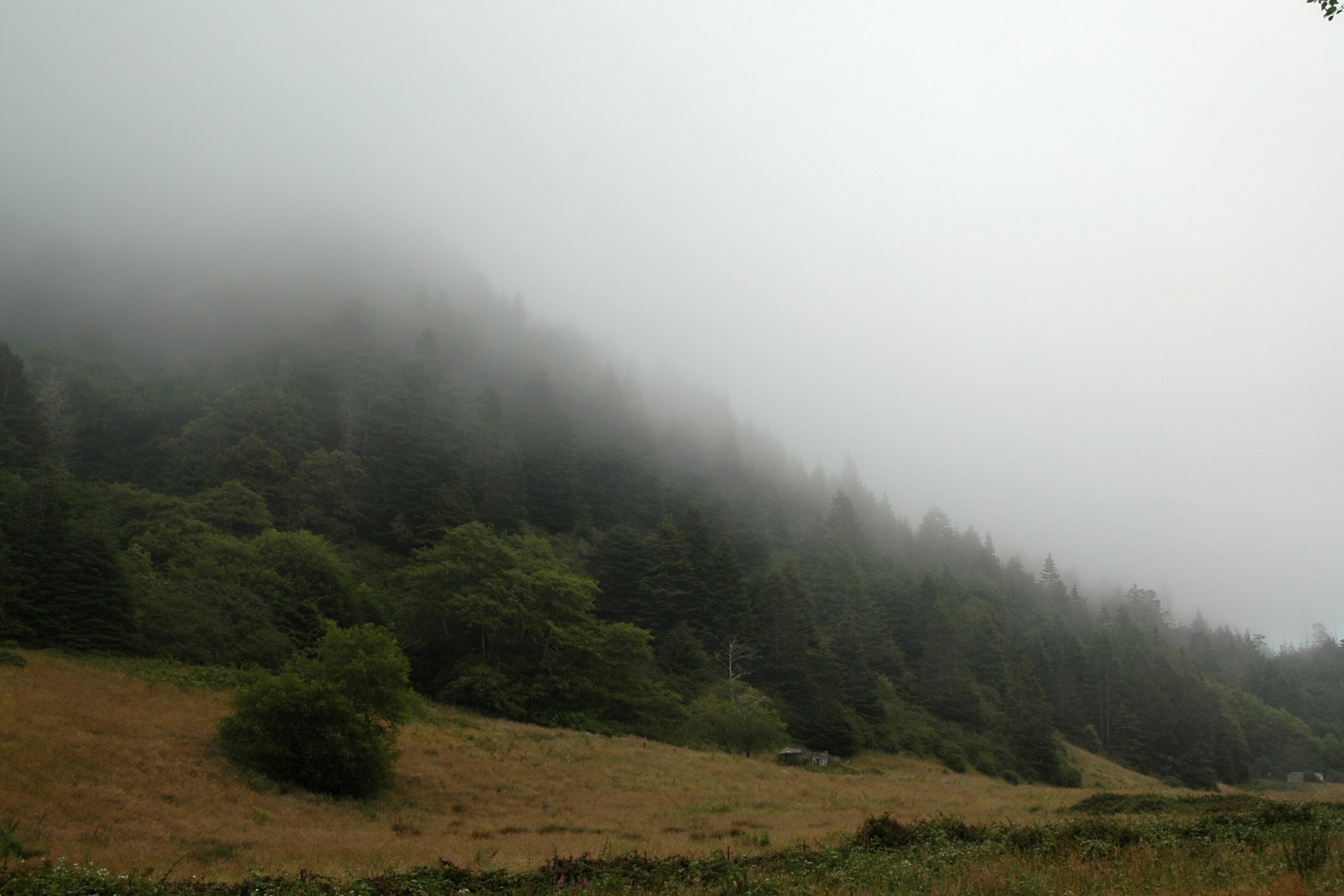
11.3b – Stratus clouds hang low in the sky as a flat, featureless, uniform layer of grayish cloud. It often arises from fog and may be accompanied by drizzle. Stratus clouds are typical for inverse weather and actually have a very negative effect on the human mood. Zdroj
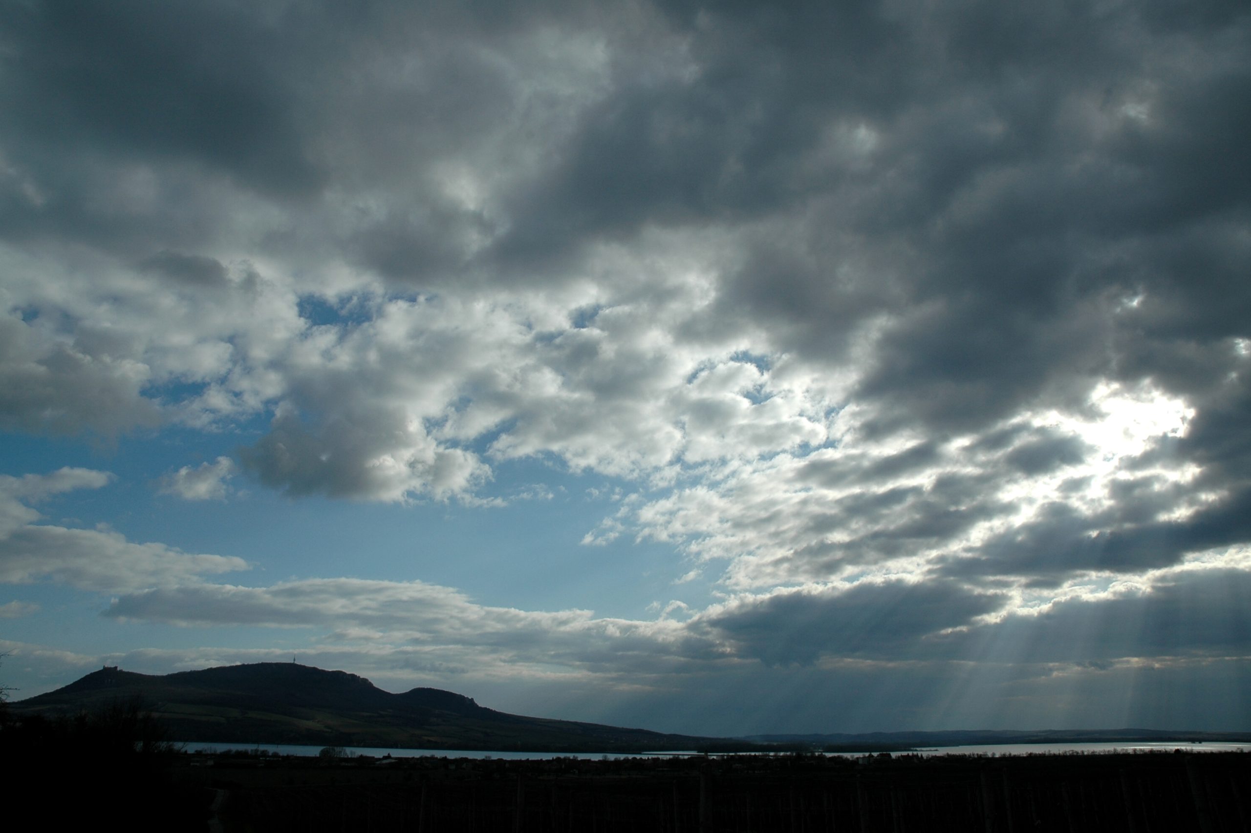
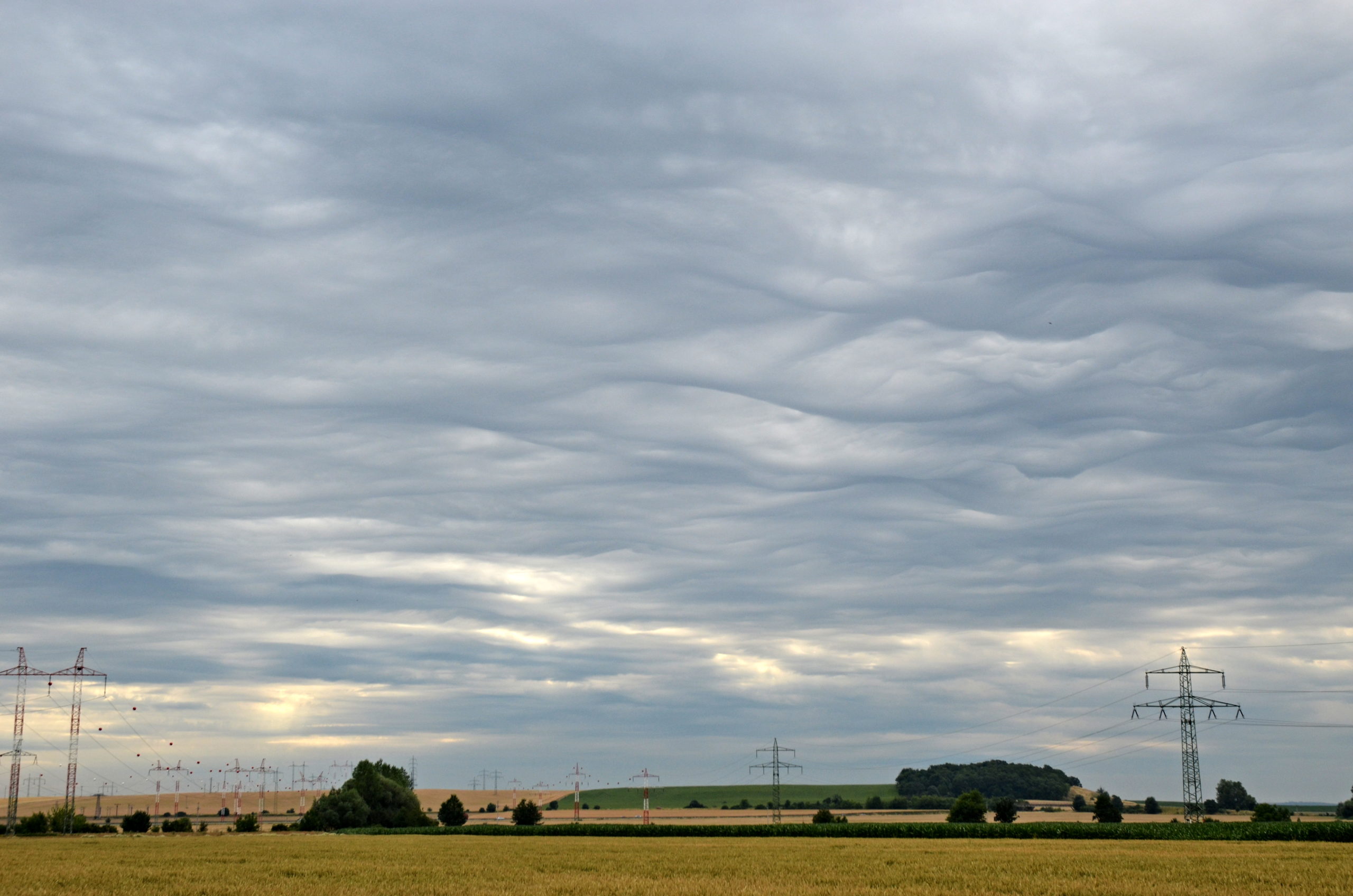
11.3c – If you spread cumulus clouds together over the sky but not into a smooth layer (like stratus), you'd get stratocumulus – low, puffy, clouds that occur in patches, often with blue sky visible in between. You're likely to see stratocumulus on cloudy days. They emerge when there's weak convection in the atmosphere, but there is some likelihood it will rain from them. Zdroj
11.3d – Altocumulus clouds are the most common clouds in the middle atmosphere. You can recognize them as white or gray patches that dot the sky in large, rounded masses or clouds that are aligned in parallel bands. Altocumulus are often spotted on warm and humid mornings, especially during summer. Zdroj
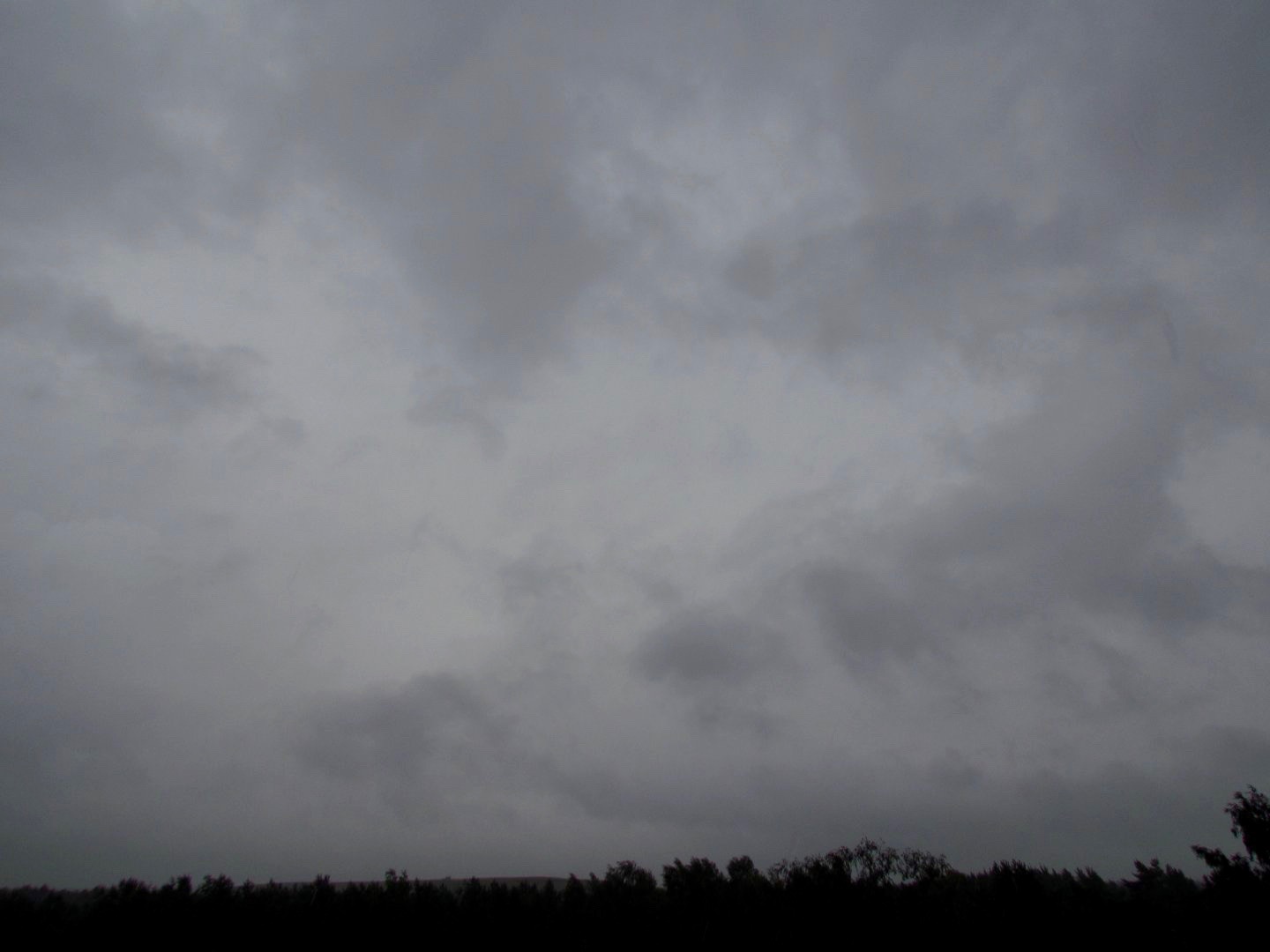
11.3e – Nimbostratus clouds cover the sky in a dark gray layer. They can extend from the low and middle layers of the atmosphere and are thick enough to blot out the sun. Nimbostratus are the quintessential rain clouds. You might see them during steady rains or snowfall over a large area. Zdroj
11.3f – Altostratus clouds appear as grey sheets of cloud that partially and/or totally cover the sky on mid-levels. Even though they seem to cover the sky completely, you can typically still see the sun as if behind them. Altostratus is a typical cloud of incoming warm front, so that you can predict the rain soon. Zdroj
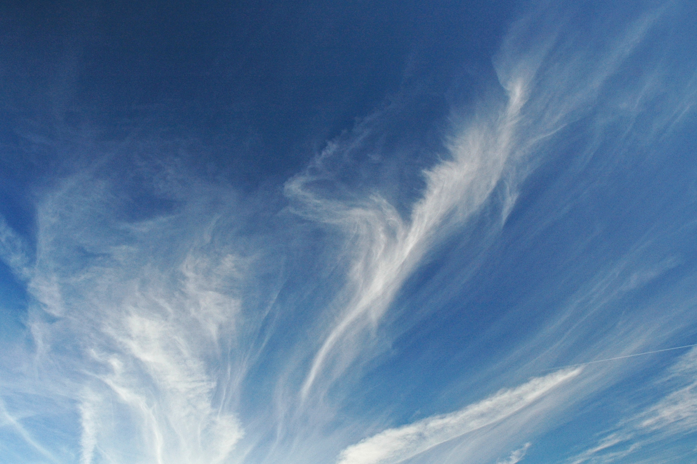
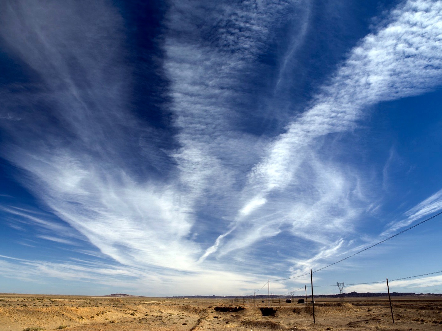
11.3g – Cirrus clouds are thin, white, wispy strands of clouds that streak across the sky. Since cirrus clouds appear in high altitudes, they are made up of tiny ice crystals. Cirrus typically occur in fair weather when the air is mostly dry. Zdroj
11.3h – Cirrocumulus clouds are small, white patches of clouds often arranged in rows; they are located in high altitudes and are made of ice crystals. The individual cloud mounds of cirrocumulus are far smaller than that of altocumulus and stratocumulus. Cirrocumulus clouds are quite rare and relatively short-lived. Zdroj
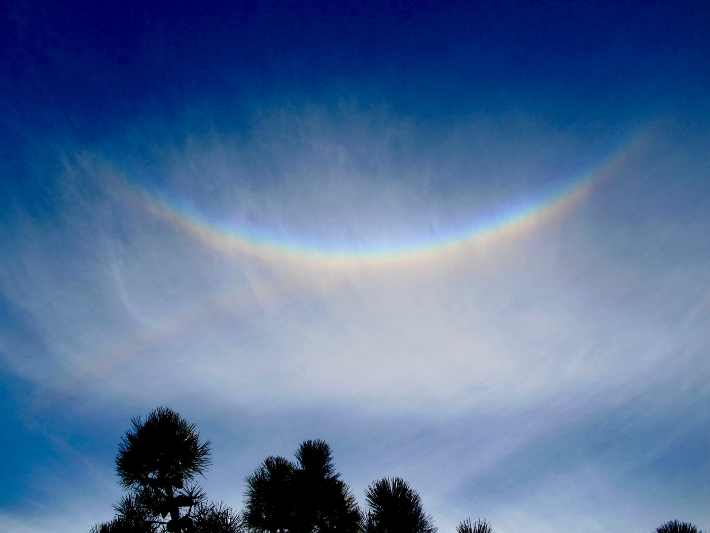
11.3i – Cirrostratus clouds are transparent, whitish clouds that veil or cover nearly the entire sky in high altitudes. If you see them, look also for a typical „halo" (a ring or circle of light) around the sun and/or moon. The halo is formed by the refraction of the light on the ice crystals. Cirrostratus indicate that a large amount of moisture is present in the upper atmosphere. Therefore, they represent the very first sign of approaching warm front. Zdroj
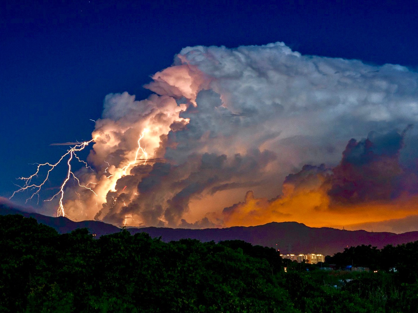
11.3j – Cumulonimbus clouds are one of the few clouds that span the low, middle, and high layers. They grow from the cumulus clouds, but rise into towers with bulging upper portions that look like cauliflower. Their bottoms are often hazy and dark. Cumulonimbus clouds are thunderstorm clouds, thus if you see one, you can be sure there's a nearby threat of severe weather. Zdroj